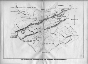
Map of Frontier Forts along Blue Mountain
Dublin Core
Title
Map of Frontier Forts along Blue Mountain
Description
Map shows the placement of forts in the 1700s between the Delaware and Susquehanna Rivers in PA. Local forts were at Slatington and at Lehigh Gap and westward at Fort Everett.
Contributor
Charles Evans
Format
map
Citation
“Map of Frontier Forts along Blue Mountain,” Slatington Postcards, accessed April 18, 2024, https://slatington.ctevans.net/project/items/show/257.
Social Bookmarking
Item Relations
This item has no relations.
Transcribe This Item

